Strong expertise in GIS, analytics, automation, and system integration
Agriculture
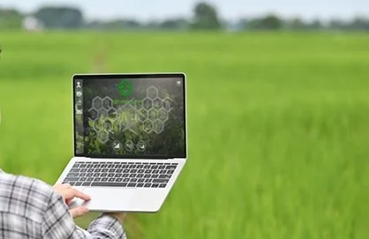
Smart agriculture solutions for higher productivity, better visibility, and efficient resource usage
SCS Tech helps agri-enterprises and agriculture organizations adopt GIS, IoT, analytics, cloud, and automation to improve crop monitoring, forecasting, field operations, and farm-to-market efficiency.
How SCS Tech India can help you
Improve crop visibility with real-time monitoring and insights

Optimize irrigation and resource use with data-driven planning

Reduce losses through early risk detection and better tracking

Improve forecasting for yield planning and supply readiness

Strengthen traceability across farm-to-market supply chains
Solutions we Deliver
GIS Mapping & Farm Intelligence Platforms
Digitize land records and field boundaries and visualize crop zones, assets, and farm performance using GIS.

Crop Monitoring & Field Data Visibility
Track crop progress and field conditions using IoT/field data inputs, dashboards, and actionable alerts.
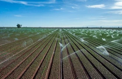
Smart Irrigation & Resource Optimization
Enable data-driven irrigation schedules and resource allocation to reduce wastage and improve yield potential.

Yield Forecasting & Predictive Insights
Improve planning using predictive models based on historical patterns, field inputs, and seasonal signals.

Supply Chain Traceability & Farm-to-Market Visibility
Track movement from farm to storage to distribution with better transparency and traceability systems.
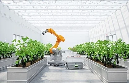
Digital Workflow Automation for Agri Operations
Digitize approvals, reporting, field workflows, and operational processes to reduce delays and improve consistency.
Why Choose SCS Tech India ?

Solutions designed for field-ready deployment and real-world monitoring

Focus on measurable outcomes: yield, efficiency, visibility, and traceability

Secure and scalable implementation roadmap
FAQs
Have questions? Find answers to frequently asked questions about.
SCS Tech provides smart agriculture solutions including GIS mapping, crop monitoring dashboards, yield forecasting, irrigation planning enablement, workflow digitization, and supply chain traceability systems—built to improve efficiency and decision-making.
Digital transformation improves productivity by enabling real-time field visibility, smarter resource planning, predictive insights, and faster operational workflows, helping teams reduce losses and improve yield planning.
Yes. We enable GIS-based farm mapping and spatial intelligence to visualize land boundaries, track performance zones, monitor assets, and support planning across large regions.
Yes. We support crop monitoring and forecasting through field visibility dashboards, alerts, historical analytics, and predictive models that improve seasonal planning and risk response.
Ready to modernize agriculture operations with smarter visibility and planning?
Let's build data-driven agriculture systems that improve productivity, reduce waste, and strengthen traceability.
Connect With Us